I recently started playing around with Google Earth, and started trying to map out the locations referenced in Yokohama Kaidashi Kikou. I've now finished a first pass through the chapters, looking for names and other clues to where things happen. I've made the results available here:
http://wakaba.c3.cx/ykk/ykk.kmz
You can either load that up in Google Earth, or you can use this online KML/KMZ file viewer that uses the Google Maps API:
http://beta.4-ch.net/kmlview/kmlview.pl?url=http%3A%2F%2Fwakaba.c3.cx%2Fykk%2Fykk.kmz
Many entries are somewhat uncertain, and are marked with (approx) for locations that I only know roughly where they are, and (wild guess) or (?) when I'm just guessing from insufficient clues and/or intuition. There are probably more locations that can be identified, so if you have a copies of YKK and Google Earth handy, and feel obsessive enough, feel free to make corrections and additions, and make your findings available! I'll try to include any suggestions for a later update.
Some unsolved questions and mysteries include:
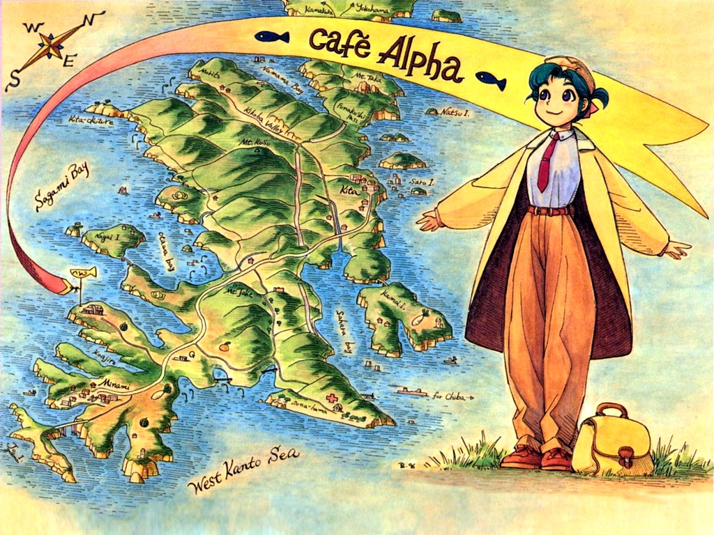
* Where exactly is Café Alpha? I've got a guess that I think is very good (especially if you compare the high-res footage available only in Google Earth with the big view here: http://ykk.misago.org/Volume1/26-27), but I am not entirely sure yet.
* And where exactly is the viewing spot that people like to go to watch submerged Yokosuka? It appears in several chapters, starting with 22 - Yokosuka Cruise. I've got the rough position for that, too, but it'd be nice to know the exact spot. It probably exists today in some form.
* Where does Alpha go to fire her gun in chapter 95 - Green? The sign implies that it is a US military area (there's a big navy base in Yokosuka), and the backgrounds show some barracks and a tower that seem to imply that Ashinano has some specific location in mind, but I can't figure it out from just those clues.
* Where is the Sandy Beach that appears in a lot of chapters, starting with 14? I've got a guess, but it's pretty uncertain.
* Where is the tower seen in chapter 129? Trying to track it down has driven me half crazy.
* And of course all the other locations marked as guesses are also unsolved mysteries, plus the locations I didn't even bother to try and place.
- WAHa.06x36
Wednesday, December 14, 2005
Oh yes: There are some corrections for the cafealpha.org translations included.
* "Daisan Katarou" in chapter 125 is actually "dai sansaro", "large three-way crossing".
* "Kyoubusaki" in chapter 128 is actually "Gyoubusaki".
* The sign in chapter 129 says "Oume Kaidou" and not "Seikaigai Road".
- WAHa.06x36
Wednesday, December 14, 2005
Cool! That was fun.^_^
- Kempis Curious
Wednesday, December 14, 2005
Utterly remarkable. Now YKK is even more alive. Many thanks.
- El Gonzo
Wednesday, December 14, 2005
Occasionally I tried looking up the places in YKK, but not really successful attempts (exept for fujiyama and yokohama ^_^). This is truly a great effort.
- painsama
Wednesday, December 14, 2005
Oh, it's great.
> * Where does Alpha go to fire her gun in chapter 95 - Green?
It's supposed to be around here:
http://maps.google.co.jp/maps?ll=35.198097,139.613056&spn=0.005330,0.018041
Some photos (by Yasukawa Chiaki):
http://www.matchbox.co.jp/gallery/yasukawa/2.html
The tower [a2002, 102] no longer exists. It has been taken down.
Here is a reference for those who understand Japanese (by miurahanto.net):
http://miurahanto.net/place/walk/nagai/
-kGo
- Kimoto Go
Thursday, December 15, 2005
Thanks! I added that, and some other corrections and additions. After looking at some Japanese pages, and Ashinano's own map, I'm pretty sure I've got Café Alpha and the sandy beach pretty close now. Still no luck on the tower from chapter 129 (http://cafealpha.org/ch129/10.html). Anybody have any clues for that one?
- WAHa.06x36
Thursday, December 15, 2005
I am amazed. Period.
- DavidF
Thursday, December 15, 2005
About the tower
try finding flight maps, being maps a pilot would use, they list tall structures, like towers.
- BlindWanderer
Friday, December 16, 2005
Found it!
http://maps.google.com/maps?ll=35.735104,139.523149&spn=0.002110,0.003720
It is called "Skytower West Tokyo", also known as "Tanashi Tower".
More info (by Nobuaki Takahashi):
http://homepage3.nifty.com/FromTanashi/EnglishTower.html
Official web site, in Japanese:
http://skytower.west-tokyo.co.jp/top.php
-kGo
- Kimoto Go
Friday, December 16, 2005
Aaah, many thanks! That one was really driving me crazy!
I've updated the KMZ file, and I also upgraded the viewer script a bit so that it works in IE. It doesn't resize properly like in other browsers, but at least it works.
- WAHa.06x36
Friday, December 16, 2005
Wow! That is very cool, thanks for all the effort you put into this.
- Silverback
Friday, December 16, 2005
Kokone's place:
I believe Kokone's place is somewhere in Minami-karasuyama.
http://maps.google.com/maps?q=%E5%8D%97%E7%83%8F%E5%B1%B1
The road sign in [v3, p41] indicates that Kokone is heading east on Route 20 and just west of intersection of 'Kanpachi' road. You can read a kanji 'yama' in Alpha's address book [v5, p21].
- Kimoto Go
Saturday, December 17, 2005
Jidokan, "children's library":
The 'jidokan', translated as "children's library" in misago.org, is located in Kinuta, Setagaya [v6, p46] [a2002, 70]:
http://maps.google.com/maps?q=%E4%B8%96%E7%94%B0%E8%B0%B7%E5%8C%BA%E7%A0%A7
Today, there are six jidokan in Kinuta area. One of them, Yamano jidokan is sometimes referred as Kinuta jidokan.
http://maps.google.com/maps?q=%E4%B8%96%E7%94%B0%E8%B0%B7%E5%8C%BA%E7%A0%A74-1-7
Though the current building of Yamano jidokan does not look like that of Kinuta jidokan in the manga:
http://www.city.setagaya.tokyo.jp/kodomo/jidoukan/jidoukan/19_yamano.html
-kGo
- Kimoto Go
Saturday, December 17, 2005
That would mean that the road with the big trees is route 20, I suppose. It seems to have trees on both sides right now, so I guess that makes sense. And Kokone comes up to it from the south, then, so she lives south of route 20.
I guess [v5, p21] is another hint to where it is, but it's too vague to be any use for me.
- WAHa.06x36
Saturday, December 17, 2005
All right, I updated the file wih your suggestions. I made a guess as to where along route 20 these two pages are: [v3, p40] and [v5, p60]. No idea if I got it right, though. It would be nice to have a marker for Kanpachi Tsuji no Cha too, but I'm not sure if it has an exact enough location for that. It should be nearby, and judging from [v6, p162] it should be on route 20, too.
- WAHa.06x36
Saturday, December 17, 2005
> I guess [v5, p21] is another hint to where it is, but it's too vague to be any use for me.
Oops, I meant [v5, p50].
- WAHa.06x36
Saturday, December 17, 2005
Kanpachi Tsuji no cha (Our poor waiter's tea shop):
The name of the tea shop suggests that it is at an intersection ('tsuji') of a road that is called 'Kanpachi'. 'Kanpachi' is a nickname for Tokyo's eighth ringroad ('Kanjo hachi go sen').
Now we know that it is also on Route 20 'Koshu kaido', which is translated as "the great Koushu road" in [a2003, 176].
And judging from the shadows in [a2002, 71], the tea shop should be located at the northwest corner of the intersection.
It is here. I'm pretty sure about it:
http://maps.google.com/maps?ll=35.672167,139.613335&spn=0.002277,0.004474
More info, in Japanese:
'Kanpachi' road
http://ja.wikipedia.org/wiki/%E7%92%B0%E5%85%AB
Route 20, also known as 'Koshu kaido'
http://ja.wikipedia.org/wiki/%E5%9B%BD%E9%81%9320%E5%8F%B7
-kGo
- Kimoto Go
Sunday, December 18, 2005
Yes, I definitely agree with that location. I added it to the map file.
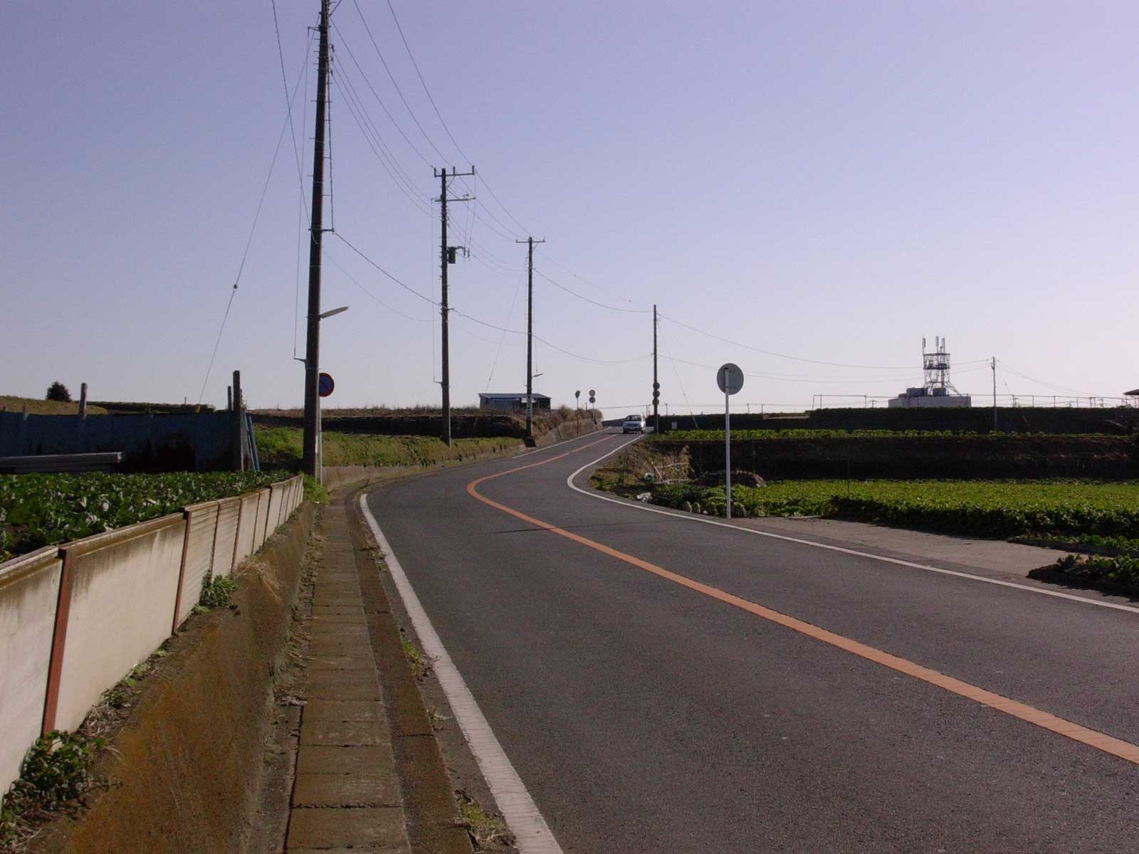
What else is there to figure out? There are a lot of locations out on Miura that I am not sure about, but those are probably hard to figure out without being familiar with the place, or at least going out there and looking. Chapter 9 ([v2, p20]) should be possible to figure out, at least. I have a guess, but no idea if it's right. There are a lot of other locations on Miura that appear (like the pier made out of blocks that Alpha and Takahiro sit and talk on - [v7, p151]), but are really vague.
Oh yeah, the valley road: [v8, p84], [a2003, p80]. Once again, I just have guesses.
- WAHa.06x36
Sunday, December 18, 2005
Valley road (with streetlight plants):
Yoshi has located that road.
"Geographic distribution" thread of this forum:
http://ykk.misago.org/Forum?cmd=show&id=1584
> Sagamihara,Kanagawa,Japan.
> I live near the Route 16(Volume8/79) and Valley Road(Volume8/88).
> Valley Road is Doushi-Michi(Doushi Road E139.1.18.7 N35.30.55.8).
>
> - Yoshi
> Sunday, August 15, 2004
It seems that Doshi-mura's part of Route 413 is called 'Doshi-michi'. The name 'Doshi-michi' is written on a paper lantern in [v8, p84].
Ayase's valley road (Ch. 106) is not the same as Alpha's (Ch. 71). I don't know where it is, but in the chapter 106, Ayase says:
"Unlike the road that runs near Mount Fuji, there's no traffic."
(My translation is a bit different from misago.org's [a2003, 80].)
- Kimoto Go
Monday, December 19, 2005
Thank You! This is a huge amount of work and you have helped us to understand YKK quite a bit more! THANK YOU!
- and I have a question.
In YKK there is a half submerged shrine in Kimakura - here is the page:
http://ykk.misago.org/Volume1/20.html
In a previous post I tried to use this scene to figure out how much the sea level has risen in YKK. - Here is the post:
http://ykk.misago.org/Forum?cmd=show&id=2922&replies=2
I was using Keyhole, which is the company Google bought and turned into Google Earth. I came up with a sea level about 120 feet above the current level. Although this is possible for science fiction it's not likely in the real world. I now suspect I may have been way off.
The google earth elevation for Cafe Alpha seems to indicate that it is only 40 to 50 feet above sea level. If that's true then the YKK sea level can be no more then 20 to 30 feet above the current level.
Do you have any thoughts on this? Is my location for the Kimakura shrine incorrect (for instance)?
- Thanks again!
- Rick King
Monday, December 19, 2005
OOPs - I screwed up my previous post.
The page with the submerged shrine is
http://ykk.misago.org/Volume8/4.html
Sorry!
- Rick King
Monday, December 19, 2005
Remember that the elevations might have changed due to earthquakes and land moves...
- Radomir Dopieralski
Monday, December 19, 2005
Ah, that would make the spot I guessed for chapter 75 make more sense, too. Map updated.
As for the town Ayase vists, we know it has a river running through it [a2003, p87], and a railway station [a2003, p83]. How about Ootsuki, as a random guess? http://local.google.com/maps?ll=35.610976,138.944607&spn=0.039509,0.048190
- WAHa.06x36
Monday, December 19, 2005
First off, I haven't tried checking for sure yet, but I think Ashinano is playing a little fast and loose with the sea levels. Well, I won't say anything definite until I check closer, if I ever get around to it.
However, I think you do have the wrong location for the shrine - I'm pretty sure that shrine is out on Enoshima:
http://local.google.com/maps?ll=35.299716,139.481392&spn=0.009916,0.018693 (There's a marker for it on my map under "Chapter 66" too. )
At least, that's how I read page [v8, p8] - Alpha is looking back out at Enoshima island, that she just visited.
- WAHa.06x36
Monday, December 19, 2005
I don't think Alpha visited Enoshima.
Alpha said "Thank you for everything you did for me" ('osewasama deshita': notice the past tense) to the kami of the shrine [v8, p4]. It must be near the place Alpha worked.
The town of Kamakura has been flooded and become a bay in Alpha's world [v2, p85]. Probably Alpha worked somewhere on the east side of Kamakura bay and took a boat to go west.
-kGo
- Kimoto Go
Tuesday, December 20, 2005
Half-submerged torii gate:
Then where is the shrine? There are a lot of shrines in Kamakura. Rick picked the most famous one, Tsurugaoka-Hachimangu.
http://local.google.com/maps?q=%E9%B6%B4%E5%B2%A1%E5%85%AB%E5%B9%A1%E5%AE%AE
According to Google Earth, the main building is at an elevation of 100 to 110 feet. But hey, there are a lot of steps between the main building and the torii gate. Google Earth says the torii is at an elevation of 40 feet. And note that the sea level is not always zero in Google Earth. The sea is at an elevation of 15 feet.
So the torii is about 25 feet above the sea level. It is likely to be the one in [v8, p4], isn't it?
Although the torii in the manga looks a bit smaller than current one, I think Rick got the right location:
http://local.google.com/maps?ll=35.323730,139.555088&spn=0.001863,0.003761
- Kimoto Go
Tuesday, December 20, 2005
You're probably right. But that one should have the stairway behind it. Or is that part of the stairway you can see vaguely in [v8, p4]? I guess it would help to compare with some pictures of various shrines in Kamakura...
- WAHa.06x36
Tuesday, December 20, 2005
That is the roof of one of the buildings of the shrine. The stairway is not drawn in the manga. Maybe we need to gather more information.
Some photos of Tsurugaoka-Hachimangu:
from their official site:
http://www.hachimangu.or.jp/shintou/manners/top.html
from the site of Enoshima Electric Railway Co.,Ltd.:
http://www.enoden.co.jp/map/hachiman.htm
from Japanese Wikipedia:
http://ja.wikipedia.org/wiki/%E7%94%BB%E5%83%8F:%E8%8B%A5%E5%AE%AE%E5%A4%A7%E8%B7%AF_%E4%B8%89%E3%81%AE%E9%B3%A5%E5%B1%85.jpg
- Kimoto Go
Wednesday, December 21, 2005
Sandy road (Young Sensei and Ojisan went for a ride):
You can find Enoshima in [v2, p120].
It should be somewhere around here, on Route 134:
http://maps.google.com/maps?ll=35.318487,139.427834&spn=0.042580,0.151989
-kGo
- Kimoto Go
Thursday, December 22, 2005
Hmm, interesting idea. I had assumed that since the segue from the last chapter implies that they start out near what later becomes the Sandy Beach and Sensei's hospital, they just go south from there on a short trip. But that does look like Enoshima, and he does say they need to take the day off to do it, so that would indicate a longer trip. Are there any other hints that you can see?
Also, I'm away from my computer over the holidays, so I won't do any updates until I get back.
- WAHa.06x36
Friday, December 23, 2005
While the forum was away, Kimoto Go made some interesting finds - see http://4-ch.net/manga/kareha.pl/1099735375/21- - and I updated the map accordingly.
- WAHa.06x36
Saturday, January 21, 2006
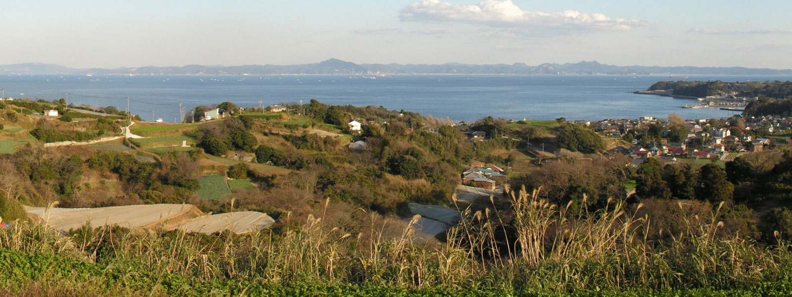
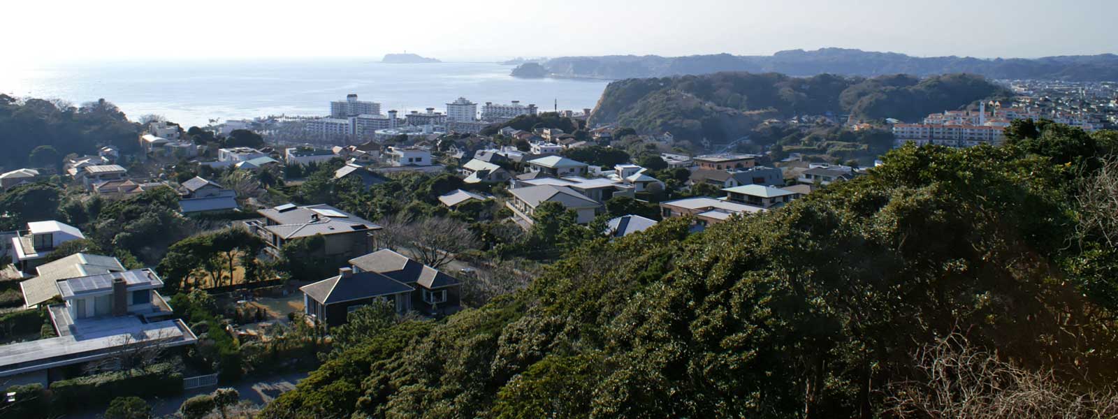
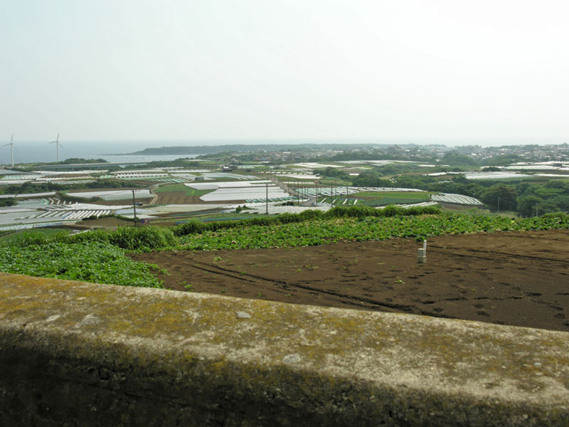
Chapter 125:
I think you can remove "guess" from the mark (or change it to "approx").
I took a photo from here:
http://maps.google.com/maps?q=35.167827,139.649009
The view:
http://kimoto.cc/ykk/map/miura-kaneda.jpg
There you can see fields, the sea and Chiba (the other side of the Tokyo bay).
And there is a blue barn!
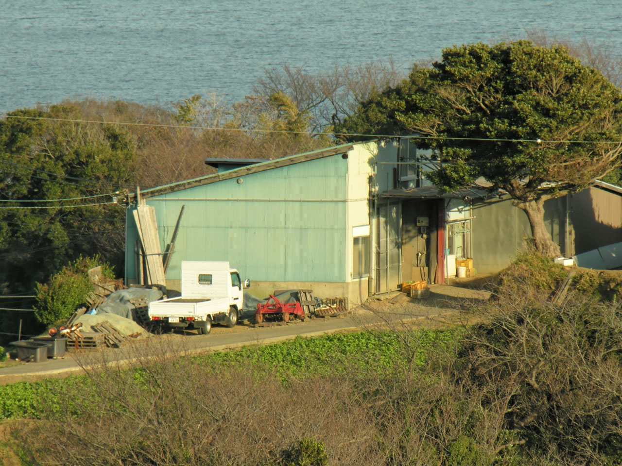
The barn, zoomed in:
http://kimoto.cc/ykk/map/miura-kaneda-barn.jpg
-kGo
- Kimoto Go
Thursday, February 2, 2006
Updated!
And that truck by that barn looks a lot like Ojisan's, doesn't it? Heh.
I'm getting really jealous of you, since you can go and look at these places! One day, I'll manage to make my way there too, though.
Oh, while you were there, you didn't happen to see any place that would fit for Chapter 9? It seems like a place that would stand out, with the bridges among the mountains, like in [v2, p20].
- WAHa.06x36
Sunday, February 5, 2006
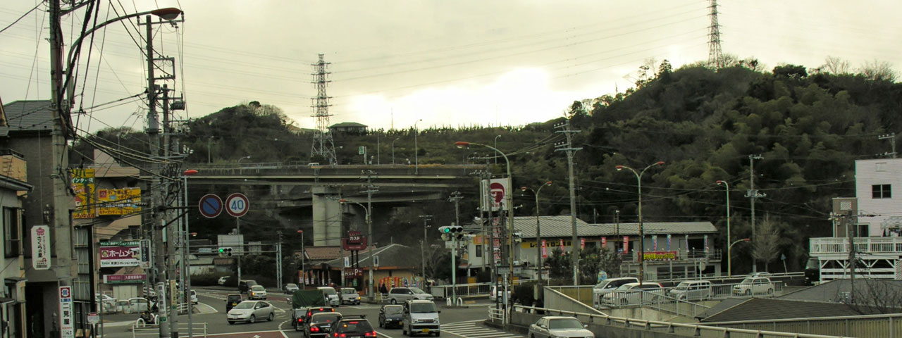
Chapter 9, Kokone shows Alpha how to use the camera while waiting for the car.
Here's a photo of the place currently marked as "wild guess":
http://kimoto.cc/ykk/map/kinugasa-ic.jpg
http://maps.google.com/maps?q=35.2418862781,139.662000326
I think it fits well enough to [v2, p20]. I haven't seen any other place like that.
I'm amazed that you found this place without being there.
-kGo
- Kimoto Go
Tuesday, February 7, 2006
If I guess enough times, sooner or later one will be the right one! Actually, first I was thinking it might be somewhere around here, because there are also bridges:
http://maps.google.com/maps?t=k&ll=35.282114,139.62769&spn=0.012069,0.014055&t=k
But on further reflection, it didn't seem to make much sense. So the current one seems a likely guess.
- WAHa.06x36
Tuesday, February 7, 2006
I finally figured out how to get the new, update footage that Google Local added for the map viewer, so now the map has much, much better footage of the Miura peninsula (the same as Google Earth).
So if you haven't had the chance to see the high-res version in Google Earth before, try looking at the map now!
http://us.c3.cx:8080/~dag/kmlview.pl?url=http%3A%2F%2Flocalhost%2F%7Edag%2Fykk.kmz
- WAHa.06x36
Friday, February 10, 2006
Gah, ignore that URL. That's the test version that's not currently set up to use the better footage. Use the normal one here:
http://beta.4-ch.net/kmlview/kmlview.pl?url=http%3A%2F%2Fwakaba.c3.cx%2Fykk%2Fykk.kmz
- WAHa.06x36
Friday, February 10, 2006
Chapter 9 [v2, p20], another guess
A Japanese fan site suggests here, an entrance of a park called 'Kurihama Hano-no-Kuni':
http://maps.google.com/maps?q=35.223141,139.702266
The fan site with photos and Japanese text (by R. Ichiro):
http://ha.cafe-alpha.com/~r-ichiro/kuri.htm
English info for the park:
http://www.city.yokosuka.kanagawa.jp/e/hananokuni/
I just went there and this is my photo:
http://kimoto.cc/ykk/map/hananokuni.jpg
But hmm..., I don't think it fits better than the place currently marked as "wild guess".
-kGo
- Kimoto Go
Sunday, February 19, 2006
I would have said they were sitting back at
35.22395,139.7024
but then i'm only looking at the sat images (as nobody has a picture of that white roofed building).
I agree, i don't think it's the right place. The proportions don't seem right.
Is that a driving school at 35.229,139.704 ?
- BlindWanderer
Sunday, February 19, 2006
Yeah, that's a driving school. I wonder how Alpha learned to drive.
- Kimoto Go
Wednesday, February 22, 2006
Ojisan's gas station
Not too sure but this is my guess.
Location:
http://maps.google.com/maps?q=35.178526,139.643548
Photo:
http://kimoto.cc/ykk/map/hanji.jpg
360-degree panorama, QuickTime required:
http://kimoto.cc/ykk/map/hanji360.qt
Currently the place is a store parking lot. The owner of the store told me that they used to sell kerosine there, but heh, NOT gasoline.
There is a place marked as "G" in Ashinano's own map. I assume it is Ojisan's gas station.
http://www.sonymusic.co.jp/Animation/yokohama/image/top.jpg
And the place "G" appears to be a little north east of this three-way crossing:
http://maps.google.com/maps?q=35.166941,139.641767
The store is also around there.
There is a place that looks like where Alpha was hit by lightning [v1, p80], near the store:
http://kimoto.cc/ykk/map/uenohara.jpg
http://maps.google.com/maps?q=35.183481,139.646659
The biggest problem for me is the fact that they have never sold gasoline!
-kGo
- Kimoto Go
Wednesday, February 22, 2006
It's a pretty good guess, judging from the map, which really is the only hint I've found for this. I'll update the map to that, until anyone figures out anything better, or confirms this one.
The three-way crossing is probably that one. That would sort of match the guess for Alpha's house, too.
I added an entry for chapter 4 and that road, too. It looks pretty good to me!
Oh, I've got a larger version the map. It's been pretty useful for finding some hints: http://wakaba.c3.cx/ykk/map.jpg
- WAHa.06x36
Thursday, February 23, 2006
How many times have I forgotten to OK my post and had to remember all the great stuff I wrote :(
Great work everyone! Thank you.
I was looking all over for places where I've walked in Yokohama. I tried to see the cats sunning themselves up on the overlook atop the hill where the Black Ships-period gaijin are buried. Not quite enough resolution for that (I'm sure the slackers at the NSA have the res to check their teeth). The Tin Toy Museum is up there somewhere, too, in the trees.
Did anyone notice the map anomaly that puts a ghost street grid under the water? Like here: http://beta.4-ch.net/kmlview/kmlview.pl?url=http%3A%2F%2Fwakaba.c3.cx%2Fykk%2Fykk.kmz
When you back out, it's an obvious error. But fun, considering what we're doing here with the maps...
- seaweb
Thursday, February 23, 2006
How about adding Minami-machi?
http://maps.google.com/maps?ll=35.144038,139.618528&spn=0.005966,0.009012
That would explain why Alpha hasn't met Ojisan before the prologue [v1, p12].
Alpha usually buys coffee beans in Minami-machi.
Chapter 32 [v5, p2]:
"Once again, coffee beans have become out of stock in Minami-machi. So my shop is closed today."
When she runs out of coffee beans and they are not available in Minami-machi, she goes to Yokohama.
Chapter 33 [v5, p12]:
"I decided to go to Yokohama to get coffee beans which I can use for the time being."
(My translations are a little different from misago.org's.)
And the mohawk guy at the shop in Yokohama says Alpha visits his shop once in 3 years or so ("extra" of Volume 11).
Now we can see that Ojisan's gas station is not on the way from Alpha's place to Minami-machi. Alpha just did not have to visit Ojisan's gas station until the prologue.
Minami-machi also appears in several other chapters:
Chapter 29 [v4, p83]
Chapter 45 [v6, p31] (Makki meets Alpha)
Chapter 50 [v6, p90] (Makki gets a swimsuit)
-kGo
- Kimoto Go
Monday, February 27, 2006
That's probably a good idea. Which area there exactly is Minami-machi? How is it written in kanji?
- WAHa.06x36
Monday, February 27, 2006
Oh, I forgot to mention. You can find the name of the town "Minami" in Ashinano's own map, at the south end of Miura peninsula. That's the only hint I see.
There's no place called "Minami-machi" in today's map, around there. I suppose people in Alpha's world gave the town the new name. Similarly, today's Yokosuka is called "Northern town" ('Kita-no-machi') in Alpha's world.
-kGo
- Kimoto Go
Tuesday, February 28, 2006
Ah, of course. I think I was looking into that when I was just starting out with the map, but then got confused by the name. Later on, I did figure out Kita-no-machi, but I never remembered to add Minami-machi. But now it's there!
I didn't add this, and I'm not sure if there's any point in doing so, but reading chapter 140 I couldn't help but try and trace out the route Alpha was taking.
She started from her place, and then went by Ojisan's over-grown gas station, and then I'm guessing she took this beach road north (which I first thought was the "Sandy Road"):
http://maps.google.com/maps?ll=35.19324,139.671679&spn=0.048819,0.053301
Then she stopped by Sensei's hospital just north-east of there, and goes past a place that looks a lot like the place she and Kokone waited for Kokone's ride home in chapter 9, and then on towards Yokohama.
- WAHa.06x36
Wednesday, March 1, 2006
I think that the beach road on today's map looks more like the submerged road in the prologue [v1, p18], than the sand-covered road in chapter 140.
Photo:
http://kimoto.cc/ykk/map/r134-sakaibashi.jpg
This photo was taken from here:
http://maps.google.com/maps?q=35.188295,139.657463
It may not be exactly the same place as [v1, p18] but the hills look similar, don't they?
By the way, the sandy road in chapter 140 appears to be the same place as [v5, p69].
-kGo
- Kimoto Go
Saturday, March 4, 2006
Kamakura fireworks (Chapter 13)
I have two guesses.
One, the hill behind Komyo-ji temple.
Two, Osaki park.
1. The hill behind Komyo-ji temple
Location:
http://maps.google.com/maps?q=35.303603,139.555442
View:
http://kimoto.cc/ykk/map/behind-komyoji-view.jpg
Same view, zoomed. (Inamura-ga-saki):
http://kimoto.cc/ykk/map/behind-komyoji-inamuragasaki.jpg
The view fits to the manga [v2, p91]. You can see Inamura-ga-saki (the other side of the bay) almost separated from the land. You can also see Yui-ga-hama (today's shoreline of the bay), which is submerged in Alpha's world.
But the place does not look like the park in the manga. It's not really a good place for a picnic.
360-degree (QuickTime required):
http://kimoto.cc/ykk/map/behind-komyoji-360.qt
2. Osaki park
Location:
http://maps.google.com/maps?q=35.294155,139.559101
Photos:
http://kimoto.cc/ykk/map/osaki-park-path.jpg
http://kimoto.cc/ykk/map/osaki-park-lawn.jpg
360-degree (QuickTime required):
http://kimoto.cc/ykk/map/osaki-park-360.qt
The park is a little small but looks a lot like that in the manga [v2, p85] [v2, p96]. It's the perfect place for a picnic.
But the view from the park looks a little different from the manga.
View:
http://kimoto.cc/ykk/map/osaki-park-view.jpg
What do you think, guys?
-kGo
- Kimoto Go
Tuesday, March 28, 2006
Hmm, that is tricky. The location does seem to match the first one, but it obviously doesn't look right. Could it be even further inland, maybe?
- WAHa.06x36
Tuesday, March 28, 2006
OK, I'll add some other places.
3. Zaimokuza cemetery, 'Shiosai' hill
Location:
http://maps.google.com/maps?q=35.308016,139.55615
View:
http://kimoto.cc/ykk/map/zaimokuza-shiosainooka-view.jpg
It is close enough to the bay. You cannot see the gap between Inamura-ga-saki and the land.
4. Zaimokuza cemetery, 'Seirai' hill
Location:
http://maps.google.com/maps?q=35.307246,139.559863
View:
http://kimoto.cc/ykk/map/zaimokuza-seirainooka-view.jpg
Nice place. You cannot see Inamura-ga-saki gap.
5. Hiroyama park
Location:
http://maps.google.com/maps?q=35.296248,139.564219
View:
http://kimoto.cc/ykk/map/hiroyama-park-view.jpg
Very good place. A bit far from the bay.
I replaced two photos in my previous post so that you can compare the views. Enjoy!
-kGo
- Kimoto Go
Wednesday, March 29, 2006
Remember when trying to match up coastal roads that the ocean has risen something like 25 feet (8 meters; as to cover the street lamps). So any of the low lieing roads like the costal road like the proposed for 1-18 would be underwater (anyway the map in Alpha's hand doesn't match that side of the map)
The Map in [v1, p18] is of this area (zoom to step 4)
http://maps.google.com/maps?q=35.21,139.64
The roads in alphas map don't all exist, it would make sence that they newer highways were built.
- BlindWanderer
Friday, March 31, 2006
I had to move the KMLViewer script to another server. The old URL doesn't work any longer, but this one should:
http://wakaba.c3.cx/kmlview/kmlview.pl?url=http%3A%2F%2Fwakaba.c3.cx%2Fykk%2Fykk.kmz
With any luck, I'll manage to put together a version that supports the flood level data mentioned in another thread soon. I'll try asking the author of that for permission first, though.
- WAHa.06x36
Wednesday, May 17, 2006
Disregard that last post! I got the go-ahead from the creator of the flooding map, Alex Tingle, for adding the flood data! I made a special version of the script with a less horribly long URL:
http://wakaba.c3.cx/ykk/ykk.pl
Click the "Flood Map" and "Flood Sat" buttons to view flooding data. The flood data server might be a suffering from some heavy load from elsewhere, so the data might not load instantly, but it should work. However, report any problems!
- WAHa.06x36
Wednesday, May 17, 2006
I visited Nanohana Park, the spot I guessed for chapter 106.
The mountain by the park, compare with [a2003, 82]:
http://kimoto.cc/ykk/map/nanohanapark-mountain.jpg
The view from the park [a2003, 87]:
http://kimoto.cc/ykk/map/nanohanapark-view.jpg
360-degree Panorama (QuickTime required):
http://kimoto.cc/ykk/map/nanohanapark360.qt
I couldn't find the gateposts and the steps shown in [a2003, 86] but I thought "Now I'm 99% sure!"
I showed the manga to an old man from around there and asked if he thought it looked like Nanohana Park. He said "Nah, I don't think they look alike". Darn...
-kGo
- Kimoto Go
Sunday, May 21, 2006
kGo, that was amazing..I looked at the photo first and then the page from the manga and it took my breath away. o_o
- Carn
Sunday, May 21, 2006
I added the photo links to the map. I also added some other things I'd forgotten earlier. Is there anything else that needs adding?
- WAHa.06x36
Monday, May 22, 2006
I have some more places to add. I need to prepare my photos for the web. Stay tuned.
- Kimoto Go
Tuesday, May 23, 2006
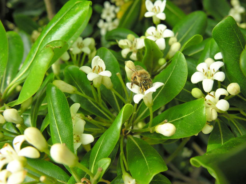
Chapter 84, Alpha and Kokone talks at a hilltop.
Some Japanese YKK fans say the place is a hill called Iwado-yama:
http://maps.google.com/maps?q=35.151609,139.64506
The south side of the hill [v9, p102]:
http://kimoto.cc/ykk/map/iwadoyama-southside.jpg
The view [v9, p103]:
http://kimoto.cc/ykk/map/iwadoyama-view.jpg
The view, 360 degree (QuickTime):
http://kimoto.cc/ykk/map/iwadoyama360.qt
In [v9, p103], Alpha says "It's not really high enough to call it a mountain, but this is the highest point around here." Iwado-yama is not really high to call it a mountain, but it is the highest hill in Miura-shi, the south end area of Miura peninsula.
I was there last weekend. There were tobera trees in bloom and smelled sweet. I'm sure Kokone smelled the flowers [v9, p104]:
http://kimoto.cc/ykk/tobera-spring.jpg
-kGo
- Kimoto Go
Thursday, May 25, 2006
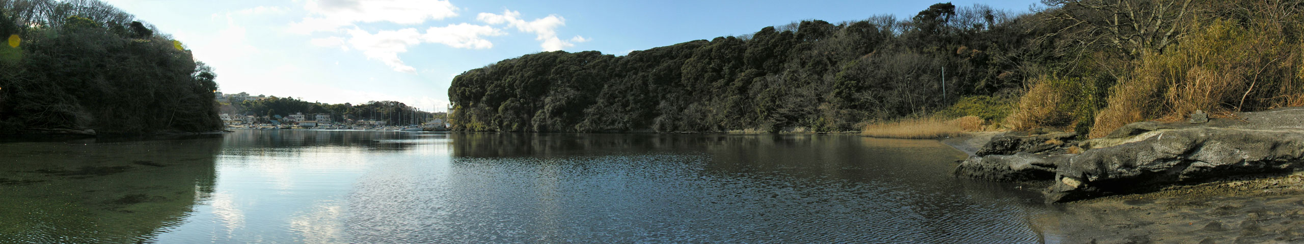
Koajiro Bay (Misago's Bay)
In [v1, p53], it is clearly mentioned that Misago lives in "Koajiro Bay".
Map:
http://maps.google.com/maps?q=35.163687,139.628398
Photo, tide is in:
http://kimoto.cc/ykk/map/koajiro-bay.jpg
360 degree photo, tide is out (QuickTime):
http://kimoto.cc/ykk/map/koajiro-mudflats360.qt
The bay is surrounded by hills and they are covered by trees and plants. It's like a little jungle.
http://kimoto.cc/ykk/map/koajiro-plants360.qt
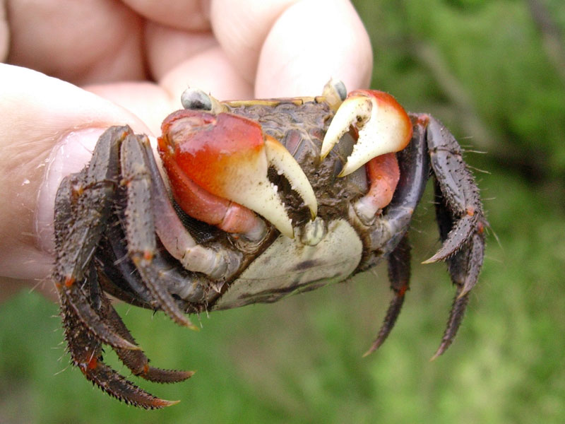
Koajiro is known as a habitat of a kind of crab, 'akategani' [v3, p131]:
http://kimoto.cc/ykk/akategani-front.jpg
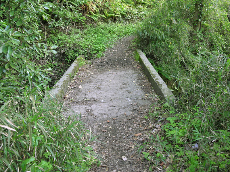
I couldn't find the point where Takahiro meets Ayase [v2, p47] or the pier Misago takes a nap on [v3, p124]. I found a small bridge but it will have to be submerged by the time Makki meets Misago [v6, p93]:
http://kimoto.cc/ykk/map/koajiro-bridge.jpg
More Information about Koajiro bay (Koajiro-wan) and surrounding area, by the Ministry of the Environment:
http://www.sizenken.biodic.go.jp/pc/wet_en/175/175.html
Note: 'Higata' in [v1, p46] is not a place-name. It is the Japanese word for "mudflats" or "tideland".
-kGo
- Kimoto Go
Monday, May 29, 2006
Looks like it's time for another update. First, though, I should figure out the locations from the Touge chapter.
How do these locations look?
From http://www.cafealpha.org/special/2.html:
The Koushuu highway runs up here: http://maps.google.com/maps?q=35.60651,138.811569
That's the same road that Kokone lived along.
Hakone-yama is here, but she's really talking about the mountains in that area in general, right? http://maps.google.com/maps?q=35.269168,138.985634
From http://www.cafealpha.org/special/6.html:
Odawara is here: http://maps.google.com/maps?q=35.245619,139.151115
And Yumoto seems to be around here: http://maps.google.com/maps?q=35.234122,139.107771
- WAHa.06x36
Tuesday, May 30, 2006
I agree on all points.
She says she is taking the steep ancient path. It sounds to be the one that leads to the Hakone pass, which used to be known as the hardest part of the Old Tokaido road.
I don't know the exact point of the Old Hakone pass but today's Hakone pass is here:
http://maps.google.com/maps?q=35.182192,139.013958
The site of the Hakone Checkpoint is near today's Hakone pass so I think it is approx enough.
The former Hakone checkpoint:
http://maps.google.com/maps?q=35.192696,139.026189
-kGo
- Kimoto Go
Wednesday, May 31, 2006
The place called "the great northern ruins" in misago.org's translation
It is called 'Kita-no-okuzure' in the original Japanese manga and marked as 'Kita-okuzure' in Ashinano's own map. The point is known as 'Choja-ga-saki' today.
The part of the west coast of Miura peninsula between Chojagasaki and Kuruwa is called 'Okuzure' today. 'O' means "big/great" and 'kuzure' means "landslide". Landslides happen there from time to time.
Map:
http://maps.google.com/maps?q=35.254118,139.580365
Photo:
http://kimoto.cc/ykk/map/chojagasaki.jpg
360 degree photo (QuickTime required):
http://kimoto.cc/ykk/map/chojagasaki-sunset360.qt
Chojagasaki also appears in PositioN chpater 4:
http://kimoto.cc/ykk/map/r134-chojagasaki.jpg
-kGo
- Kimoto Go
Sunday, June 4, 2006
The road that looks more like a dike, [v2, p116]
Map:
http://maps.google.com/maps?q=35.24285,139.595944
Photo:
http://kimoto.cc/ykk/map/r134-akiya.jpg
Maybe it's trivial...
-kGo
- Kimoto Go
Monday, June 5, 2006
It's a really good match, though, so I think I'll add it. If I could just get off my lazy ass and make the needed update.
- WAHa.06x36
Wednesday, June 7, 2006
All right, map finally updated!
- WAHa.06x36
Saturday, June 10, 2006
Otsukare! Now how about this?
There was a suggestion for the Cliff Water (Chapter 103) in a Japanese discussion forum.
Map:
http://maps.google.com/maps?q=35.16852,139.618013
Cliff [a2003, 40]:
http://kimoto.cc/ykk/map/mito-cliff.jpg
Basins [a2003, 41]:
http://kimoto.cc/ykk/map/mito-basins.jpg
I think the place looks similar but I'm not sure if it is the right place. The basins are less than 2 meter above the sea level and must be submerged in Alpha's world. There is no square concrete trough. And the water didn't taste mossy.
-kGo
- Kimoto Go
Monday, June 12, 2006
I think I found the place of the last page of the epilogue.
Photo:
http://kimoto.cc/ykk/map/miharashichaya.jpg
This photo was taken from here:
http://maps.google.com/maps?ll=35.208407,139.057066
On a clear day you can see the town of Odawara.
Zoomed in:
http://kimoto.cc/ykk/map/miharashichaya-odawara.jpg
360-degree photo, QuickTime required:
http://kimoto.cc/ykk/map/miharashichaya360.qt
-kGo
- Kimoto Go
Sunday, August 27, 2006
Nice! Map updated with the pictures.
I convinced a friend who's also a YKK fan that it would be fun to go biking on Miura. If I can arrange things, I might try doing that sometime next year. I'd really like to get some photos of my own!
- WAHa.06x36
Sunday, August 27, 2006
Looks like Google finally added support (that actually works) for viewing KML and KMZ files directly in Google Maps. So you can view the YKK locations by using this URL:
http://maps.google.com/maps?q=http://wakaba.c3.cx/ykk/ykk.kmz
- WAHa.06x36
Saturday, September 2, 2006
Howdy,
I get the following error:
File not found at http://wakaba.c3.cx/ykk/ykk....
Best,
Dave
- dDave
Saturday, September 2, 2006
When I said "(that actually works)", I was referring to the fact that it used to throw exactly that error instead of doing anything useful. However, it has since started working for me (and still does, I just checked), but it seems you get the old behaviour. Very mysterious.
I'm pretty sure it's Google's problem, though, and hopefully they'll have it working for everyone soon.
- WAHa.06x36
Sunday, September 3, 2006
Chapter 73, Alpha sells roast corn [v8, p106-107]
Some Japanese YKK fans say it is the place called 'Panorama-dai', near Lake Yamanaka. I checked it.
map:
http://maps.google.com/maps?q=35.412496,138.909373
photo:
http://kimoto.cc/ykk/map/panoramadai.jpg
360-degree photo (QuickTime required):
http://kimoto.cc/ykk/map/panoramadai360.qt
There was no food stand but yes, I believe this is the place.
-kGo
- Kimoto Go
Monday, September 4, 2006
Yes, there is definitely no doubt that that is the place! Updated the map with the photos, and removed the "(guess)".
It was a pretty good guess I had, though. I was just a couple of kilometers off.
- WAHa.06x36
Monday, September 4, 2006
Chapter 78, Alpha sits and watches Mount Fuji on the way back from her year-long trip. [v9, p28]
I think I found the place:
Map:
http://maps.google.co.jp/maps?q=35.175523,139.630308
Photo:
http://kimoto.cc/ykk/map/fuji-mito.jpg
You can find some phone poles between the hills. On a clear day you can see Mount Fuji floating over the sea. Fuji in my photo looks a bit smaller than that in the manga, though.
360-degree photo (QuickTime required):
http://kimoto.cc/ykk/map/fuji-mito360.qt
-kGo
- Kimoto Go
Friday, December 8, 2006
Added!
That's a really hard spot to confirm, but it is where you'd expect it, somewhere between Alpha's house and the gas station.
Also, that's some nice lighting you managed to capture in those photos.
- WAHa.06x36
Friday, December 8, 2006
Reply to this topic
Topic list